Public access
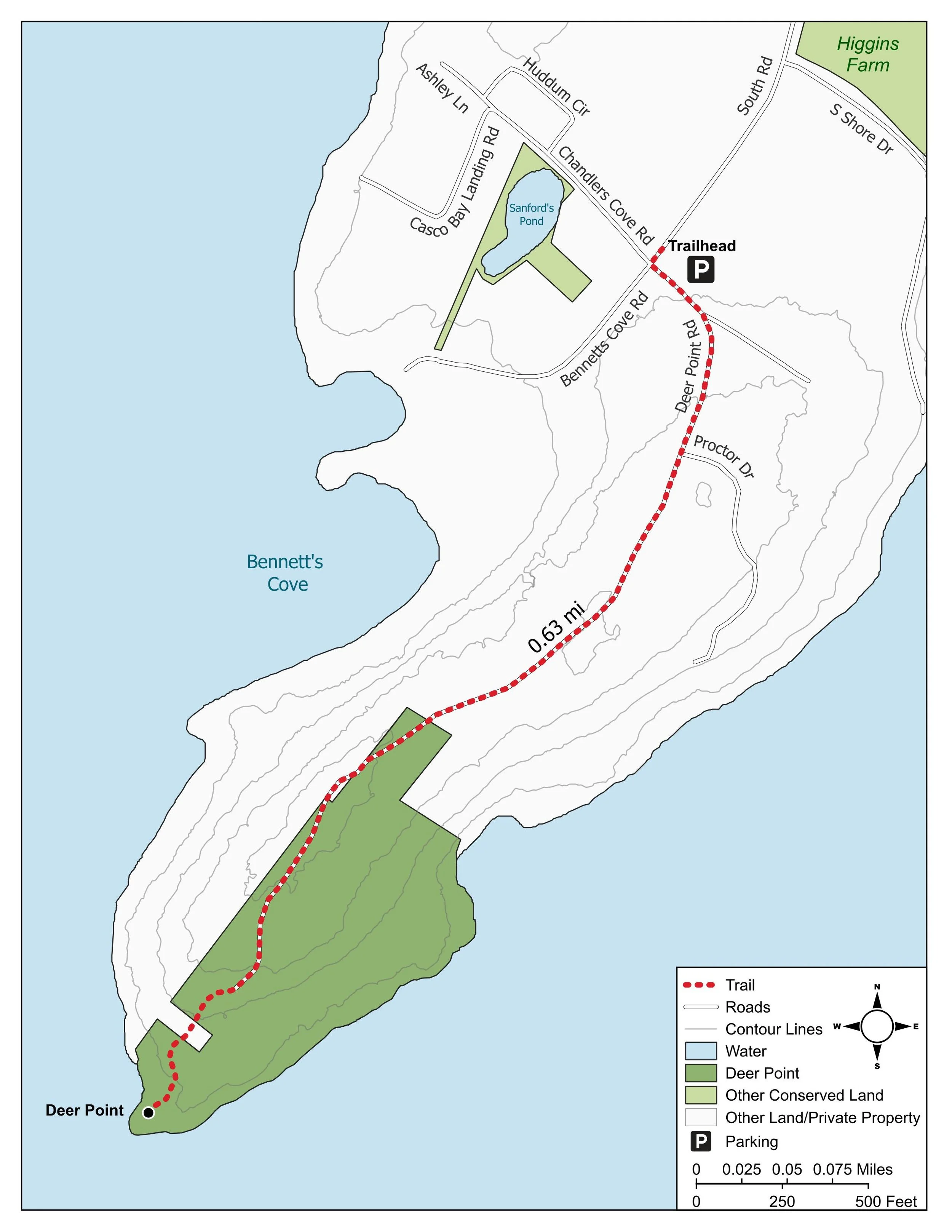
Pedestrian access along the road and to the trail that goes to the point. Visitors must stay on the marked trail.
LOCATION
Southwest tip of Chebeague Island. Park along South Road near Bennett's Cove.
trail DESCRIPTION
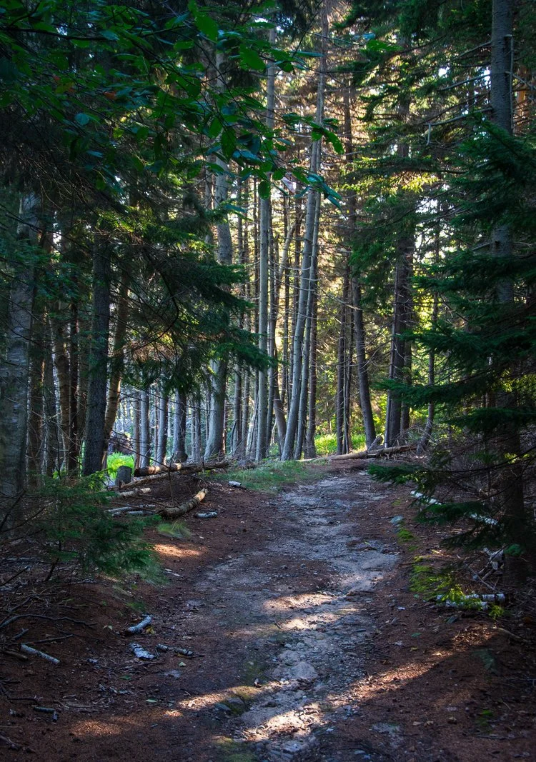
Heading down the dirt Deer Point Road, visitors can continue onto a trail through the woods to the rocky point overlooking the ocean. The trail is narrow, rugged, rocky, and uneven in some spots. There are often wet areas after precipitation. A bench is available for resting and admiring the expansive coastal view at the tip of the point.
size + distance
1.25 miles round trip / 13 acres total

PROPERTY DESCRIPTION
With its spruce forest, shoreline access, and panoramic views of Casco Bay, Deer Point has been a favorite spot for generations of islanders for walking and picnicking. Thanks to a generous landowner, CCLT was able to permanently conserve these 13 privately owned acres in 1998. The two acres at the tip of the point are protected with a "forever wild" easement, meaning that the point will stay in its natural and scenic condition, and accessible to the public, forever.
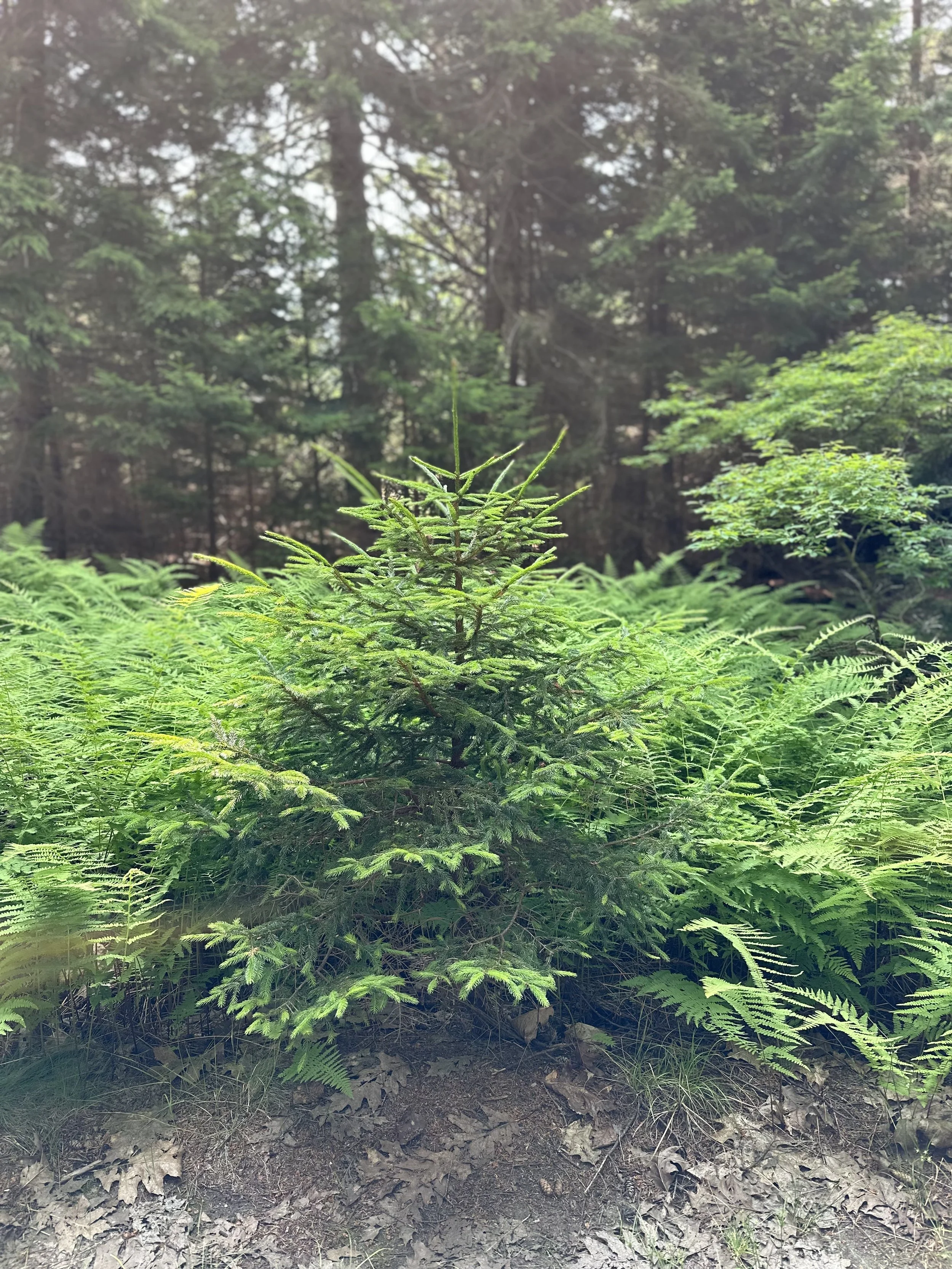
The forest is predominantly mature spruce with some hardwood trees. Deciduous shrubs, including highbush blueberry, dot the rocky outcroppings. The shoreline provides valuable habitat for tidal wading birds and waterfowl. During World War II, the U.S. Army built the road to Deer Point to reach a facility where soldiers worked to prevent enemy submarines from entering Portland Harbor.