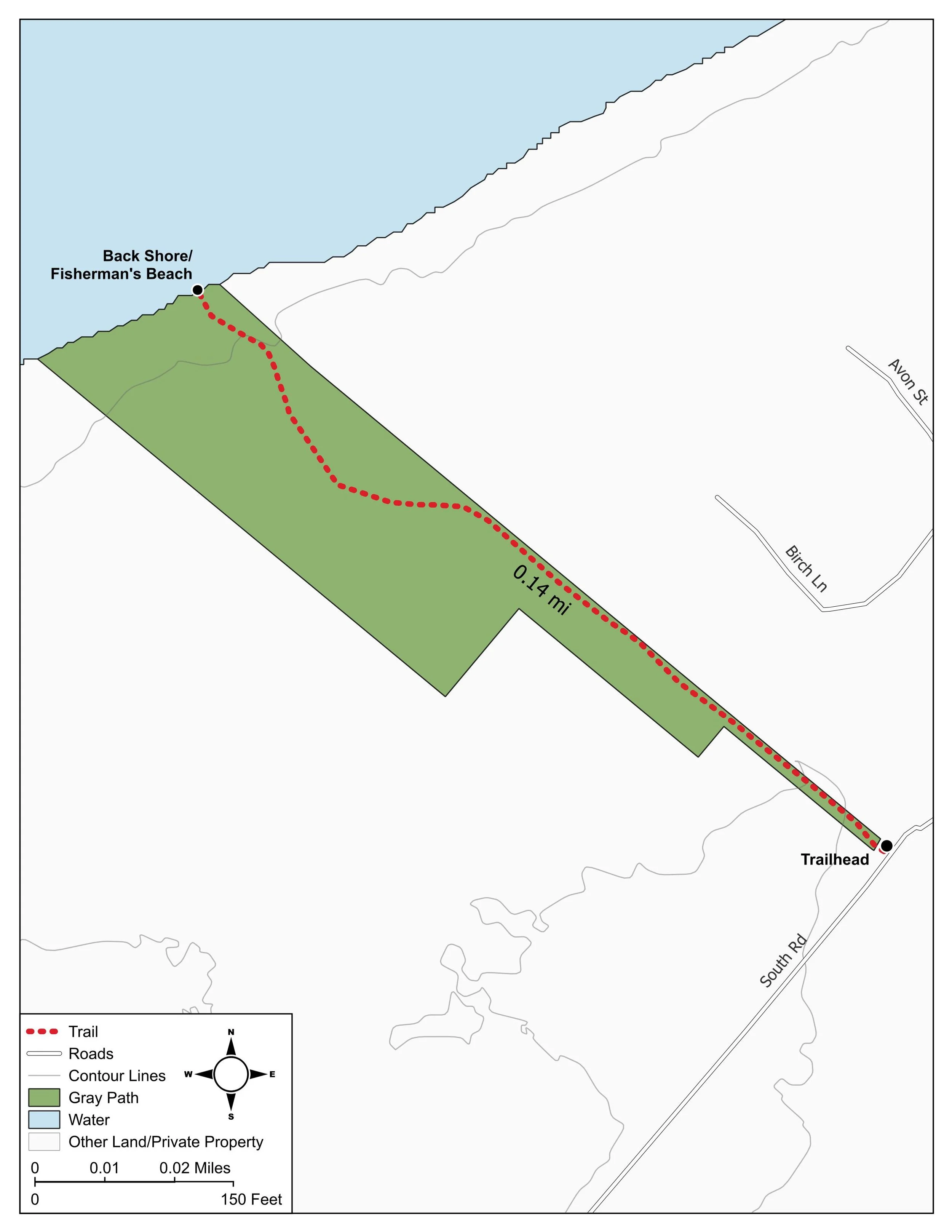
LOCATION
On the western shore of Chebeague Island’s East End, Gray Path begins at One South Road. Parking can be found along South Road (see Google map below).
distance + SIZE
.28 miles round trip / 1.2 acres
Public access
The path and shoreline are open to the public year round. Please stay on the marked trail.
trail DESCRIPTION
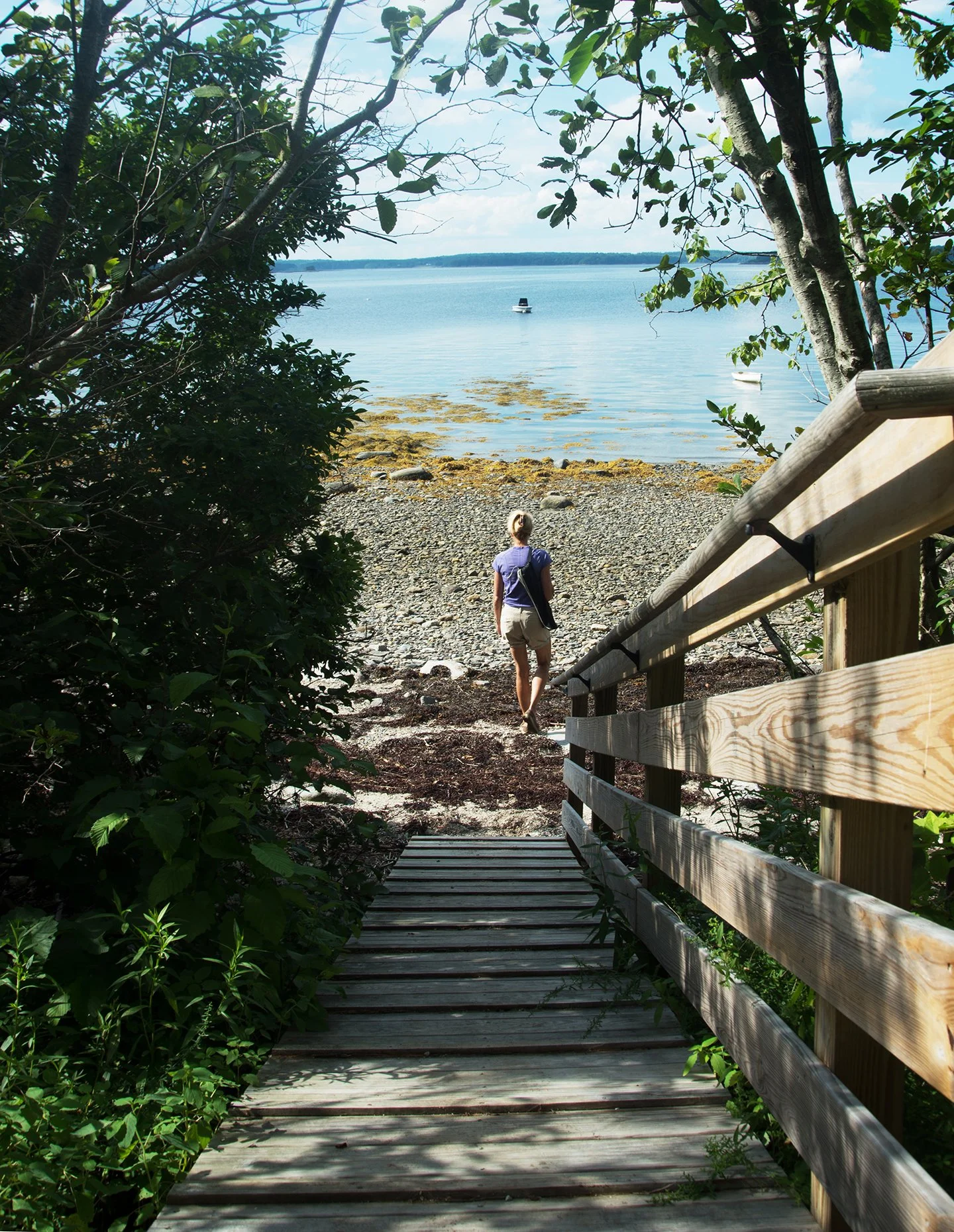
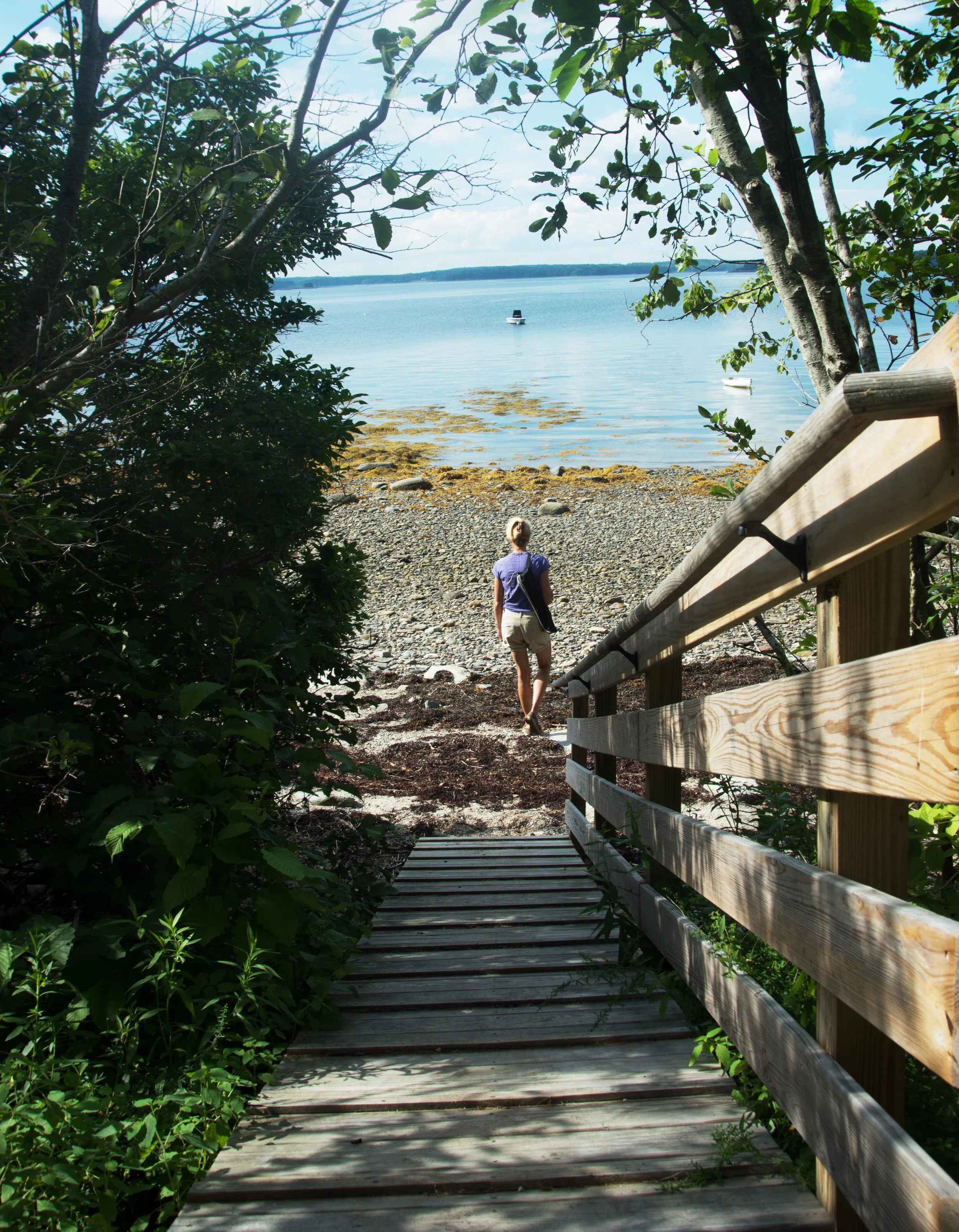
The trail passes through a mowed field between two properties and a wooded area before descending to the shore via a set of wooden stairs and a ramp. The trail in the wooded area is rooty and contains a bench. The stairs have rails on each side. The ramp is steep and can be slippery when wet, but has grip material on it.

PROPERTY DESCRIPTION
Gray Path provides valuable public access to a quiet and beautiful west-facing beach. The shoreline offers sunset views and scenic vistas of Littlejohn Island, Moshier Island, and the entrance to the Royal River in Yarmouth. Thanks to the generosity of Sheila Jordan and her brother Garland Gray, who granted a conservation easement to CCLT, the public will always have access to this special spot on the island’s East End.
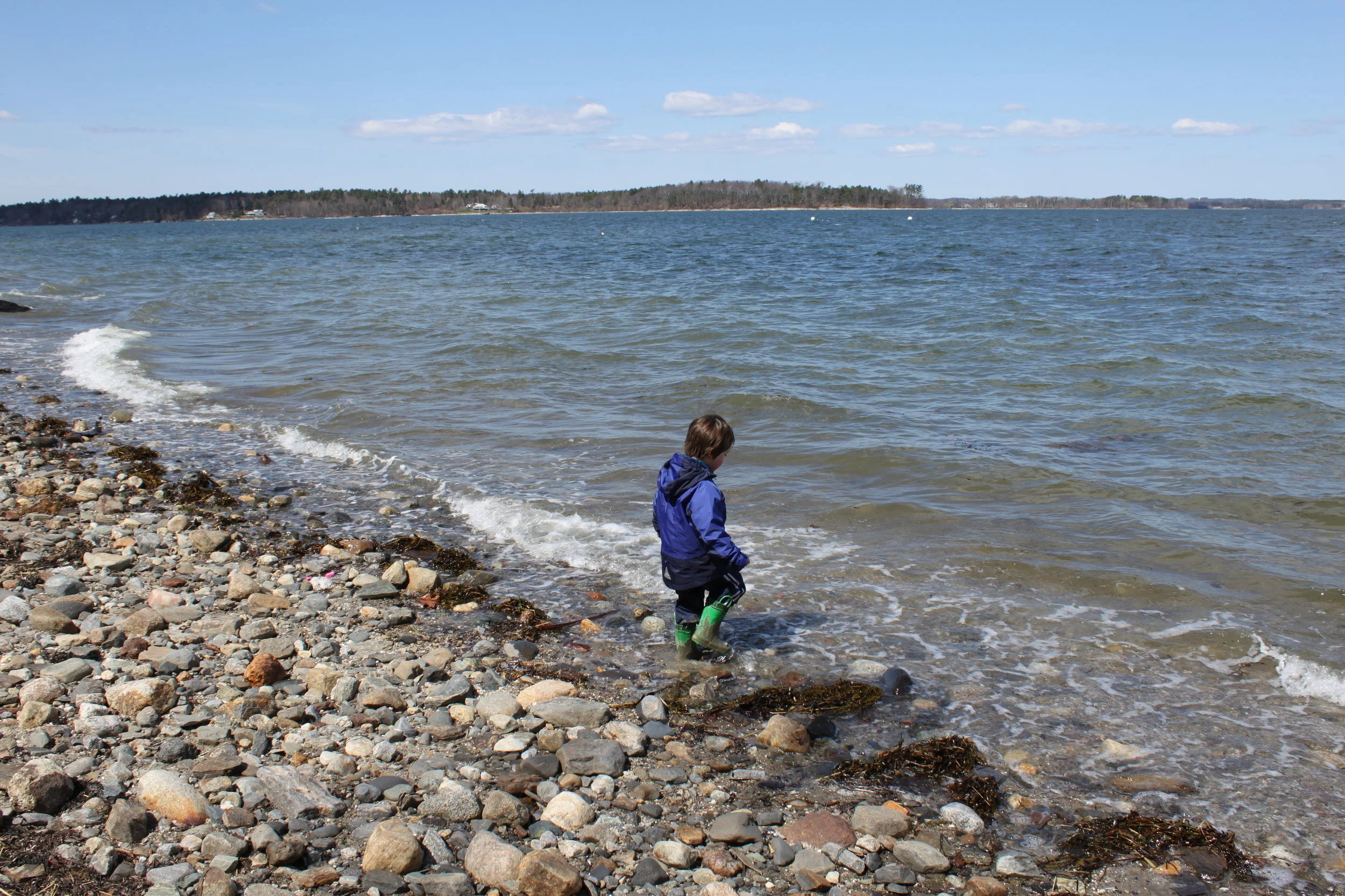
Known as the Back Shore and also Fisherman’s Beach, this stretch of shoreline was used by fishermen who lived nearby and moored their boats in its sheltered waters. Although just over an acre in size, the property spans diverse natural areas, such as a meadow, woodlands, vernal pools, and 150 feet of shoreline on Casco Bay. Great Blue Herons often gather on the beach at mid to low tide.